Connect your IoT devices to world-leading mapping solutions from Google and HERE Technologies to turn location data into actionable insights. Track assets, optimise routes and power better customer experiences at scale.
 Google and HERE Mapping Solutions
Turn Geospatial Data into Business-Critical Intelligence


Optimise Your Operations With Enterprise-Grade Mapping APIs
Legacy GPS and mapping systems weren’t built for environments like urban canyons, underground facilities or remote industrial sites.
The resulting signal dropouts cause poor location accuracy, while costly licensing models erode your performance and profitability over time.
That’s why we integrate Google and HERE’s world-leading mapping APIs directly into your IoT estate.
You get the real-time visibility, precision and reliability your operations demand in a single monthly subscription.
Precision Location Tracking Powered by Google and HERE
Monitor the exact location of vehicles, assets or field workers at any given time to provide real-time updates to customers, optimise routes and drive operational decisions.

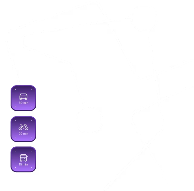
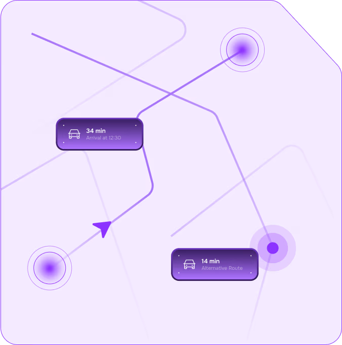
Optimised Routing in Real Time
With Google and HERE’s dynamic routing, avoid traffic congestion, road closures or accidents to minimise delivery times and costs. Your operations stay agile, accurate and ahead of schedule.


Custom Mapping for Full Context
Tailor your maps with zones, geofences, trigger alerts and real-time overlays that align with how you move, track and manage assets. These layers provide relevant contextual information to improve decision-making and planning.
Location Accuracy in the Toughest Environments
Where standard GPS often degrades in dense urban environments, Google and HERE mapping solutions deliver precise positioning where it matters most. They combine GPS with Wi-Fi, cellular and A-GPS/RTK tech.

Geocoding That Eliminates Costly Errors
Leverage advanced geocoding to convert physical addresses into precise geographic coordinates – cutting failure rates and improving customer trust.

Global Coverage with Local Precision
Track assets, vehicles or shipments in real time with always-on, accurate positioning. Both Google and HERE offer extensive global coverage to maintain accuracy across borders.

One Interactive View for Your Entire IoT Estate
Enable your operators to monitor and troubleshoot devices and connectivity in real time with the Hyper Vision View Console. This unified, visual dashboard enhances operational efficiency.

How Google and HERE Mapping Solutions Work
Google Maps: Accurate, Live Data
Access a trusted range of tools to integrate mapping, geolocation and geospatial data.
- Maps: Detailed maps with high-resolution satellite imagery, street-level views and rich geographic context.
- Routes: Advanced routing solutions for driving, cycling, walking and public transport directions, along with real-time traffic information and travel time estimations.
- Places: Integrate information such as store locations, customer reviews and points of interest (POIs) into your platforms and applications.
HERE Technologies: Flexible Mapping
Access geographically accurate data, particularly in remote or challenging environments.
- HERE Maps: Detailed interactive maps with geocoding. Personalise the way your maps are displayed with your branding, key locations and custom data sets.
- HERE Routing: Advanced route planning with real-time traffic updates, toll cost estimation and alternative routes to avoid congestion.
- HERE Tracking: Track assets in real time and use geofencing to set up virtual boundaries and trigger-based alerts for assets or vehicles, even in areas with limited connectivity.
Why Leading Enterprises Rely on Google and HERE
End-to-end integration with your existing platforms.

Accurate geolocation, even in dense urban or remote environments.

Real-time tracking that keeps your operations moving and your teams informed.
Custom layers that align mapping visuals with your business priorities.
Geofencing and event triggers that power smarter, faster decision-making.

Optimised data handling to reduce strain on your systems and your team.

Global coverage with the local precision your deployments demand.

Proactive monitoring through a visual console built for real-time action.

Enterprise-grade security that protects every location data point.

Hyper Logical: End-to-End Solutions Provider for Internet of Things
Consultation and Customisation

We work closely with you to understand your specific needs and customise mapping solutions to suit your business goals. Whether it’s creating custom maps, integrating geolocation APIs or setting up geofencing capabilities, we provide the technical expertise needed to tailor your solution.
Seamless Integration

Our end-to-end intelligence solutions are designed to integrate smoothly with your existing IoT platforms, business applications and data management systems.
Enhanced Security

We protect your location-based data and ensure you comply with privacy requirements by deploying end-to-end encryption, access control and anonymised processing.
Efficient Data Management

We’re experts in IoT edge computing. By reprocessing your location data at the source, we ensure your central systems handle only relevant location updates, minimising system strain for better performance.
Scalable Subscription Model

By leveraging Google and HERE subscriptions, we offer flexible, scalable access to mapping services, enabling cost-effective deployment without compromising on quality or functionality.
Take Full Control of Your Location Data with Google and HERE Mapping Solutions
Schedule a free consultation with our experts to see how you can access highly accurate geolocation and geospatial data for your moving assets. We’ll scope your requirements, recommend the best mapping setup and help you deploy it quickly with full technical support.

Everything You Need to Know About Our Location Services
From overcoming GPS signal loss to cutting costs and handling massive data volumes, the right mapping layer makes or breaks your operation. With simple-to-understand subscription costs at a monthly fee, you don't incur capital expenditure (CAPEX) for mapping; operating expenditure (OPEX) is flexible and offers a lower monthly cost for the life of the deployed asset.
- Is there a way to reduce the cost of using geospatial data?
Yes. We partner with Google and HERE on a subscription model that uses tiered data plans so you avoid high upfront fees and only pay for the data you need. Geospatial data caching also reduces API call frequency to manage costs effectively.
- How does Hyper Logical turn location data into business intelligence?
Our platform uses edge computing, data aggregation and smart filtering to process only relevant updates. Combined with our application enablement platform, you can build custom dashboards, apps or send data to any enterprise BI system.
- Can I view mapping data alongside device status in real time?
Yes. Our Hyper Vision View console overlays location data with device metrics, enabling your teams to monitor, detect anomalies and troubleshoot instantly.
- Will this scale as I grow my IoT deployment?
It’s built to. Whether you’re managing a small fleet or scaling to enterprise-wide deployments, our solution provides cloud-based flexibility and usage-based pricing to scale with your growth.
Explore Our IoT Services